| Lukasz Bielecki's
Historical Maps of Poland |
|
 |
 |
 |
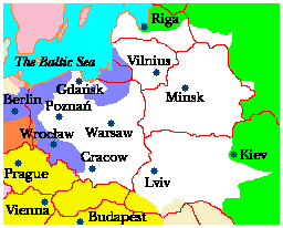
| Central Europe in 1772. |
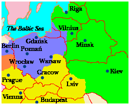
Central Europe in 1795. |
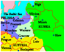
Central Europe in 1815 after the Congress of Vienna. |
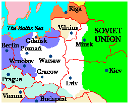
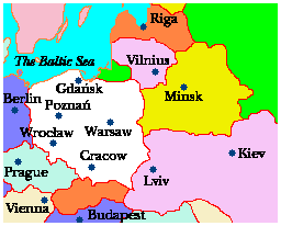
Key: Poland is marked in white; Russia - in green, Austria - in yellow and Prussia/Germany - in blue. Present-day political boundaries are shown as red lines.
 |
The viewer is strongly urged to visit Lukasz Bielecki's The Brief history of Poland in the last 200 years, the original webpage from which these superb maps are taken and where they are fully explained. |
 |
| Central Europe in 1920. |
Central Europe in 2000. |
|