 |
| Maps of Poland | Click on image for full size map |
 |
 |
 |
 |
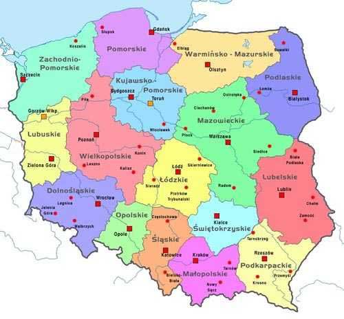
| Administrative Map voivodships 400 x 400 pixels - 30k |
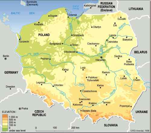
Physical elevations 624 x 400 pixels - 19k www.polorbis.co.uk/ info.htm |
Outline Map showing towns, borders 300 x 362 pixels - 15k |
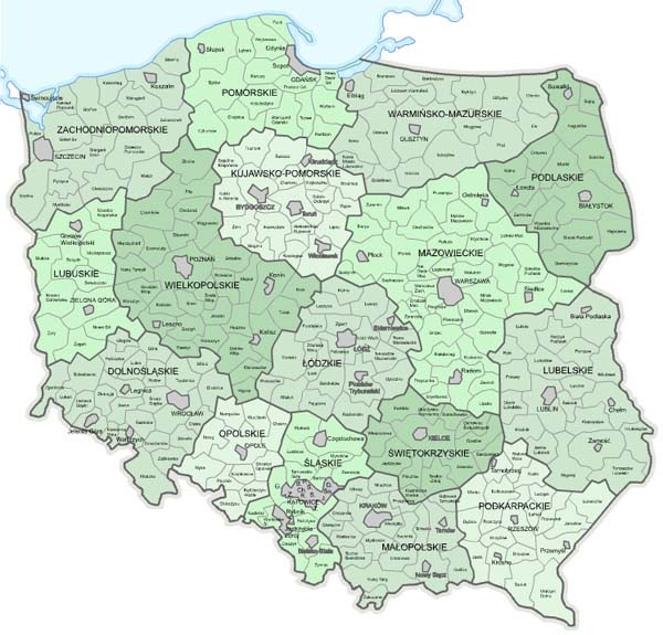
Administrative showing voivodships, powiats, gminy 600 x 575 pixels - 99k |
 |
 |
 |
 |
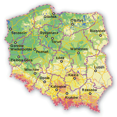
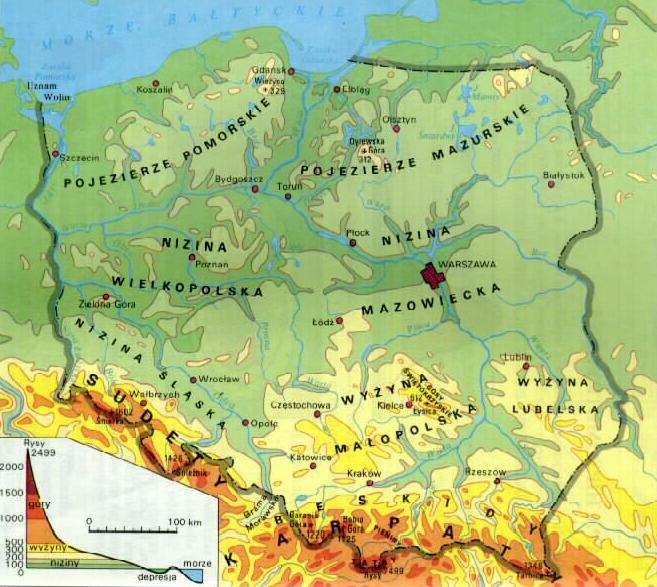
| Administrative voivodships and elevations 500 x 464 pixels - 30k |
Poland: Topographic Map shows elevations 657 x 587 pixels - 80k polandtrade.com.hk/img/mapa1.jpg |
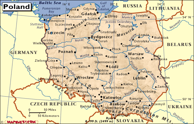
Physical towns, rivers 500 x 440 pixels - 19k |
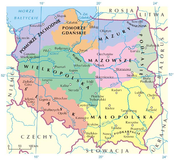
Administrative major regions, towns, rivers 610 x 560 pixels - 87k |
 |
 |
 |
 |
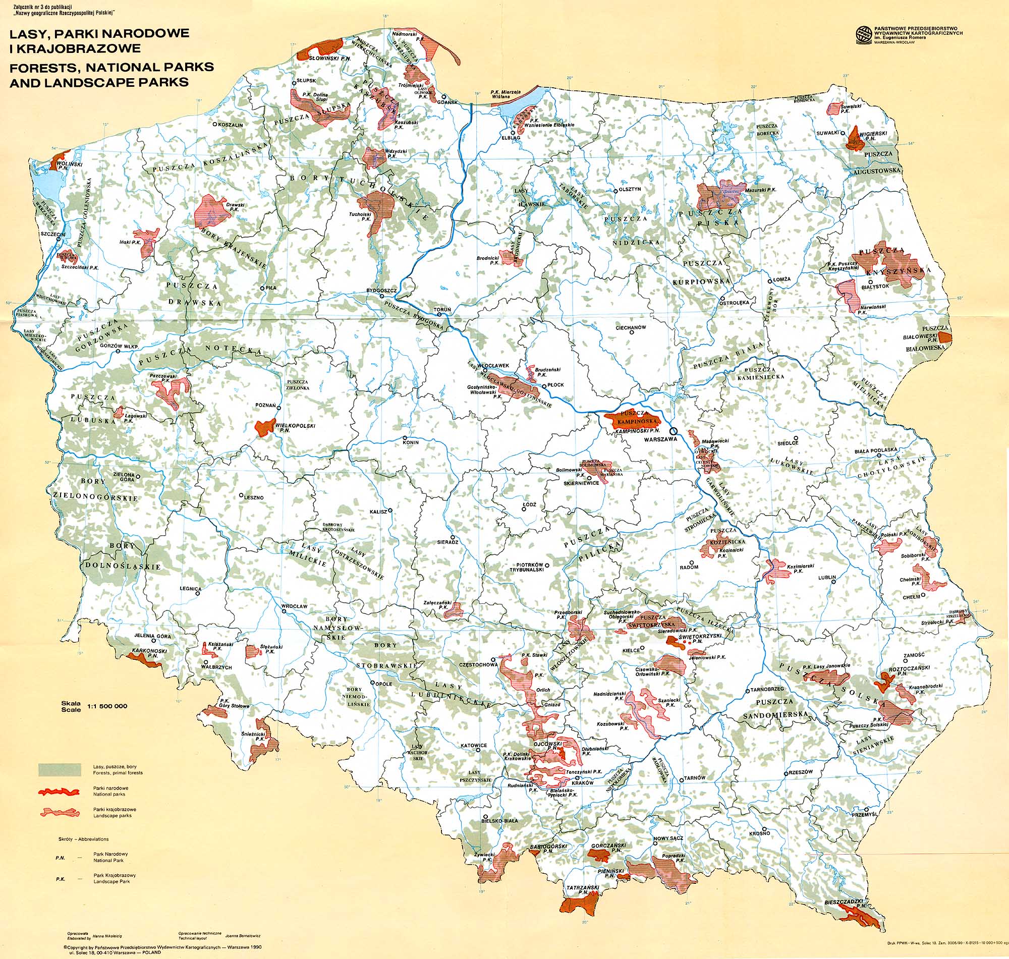
| Poland showing National Parks %& Forests 2000 x 1901 pixels - 566k |
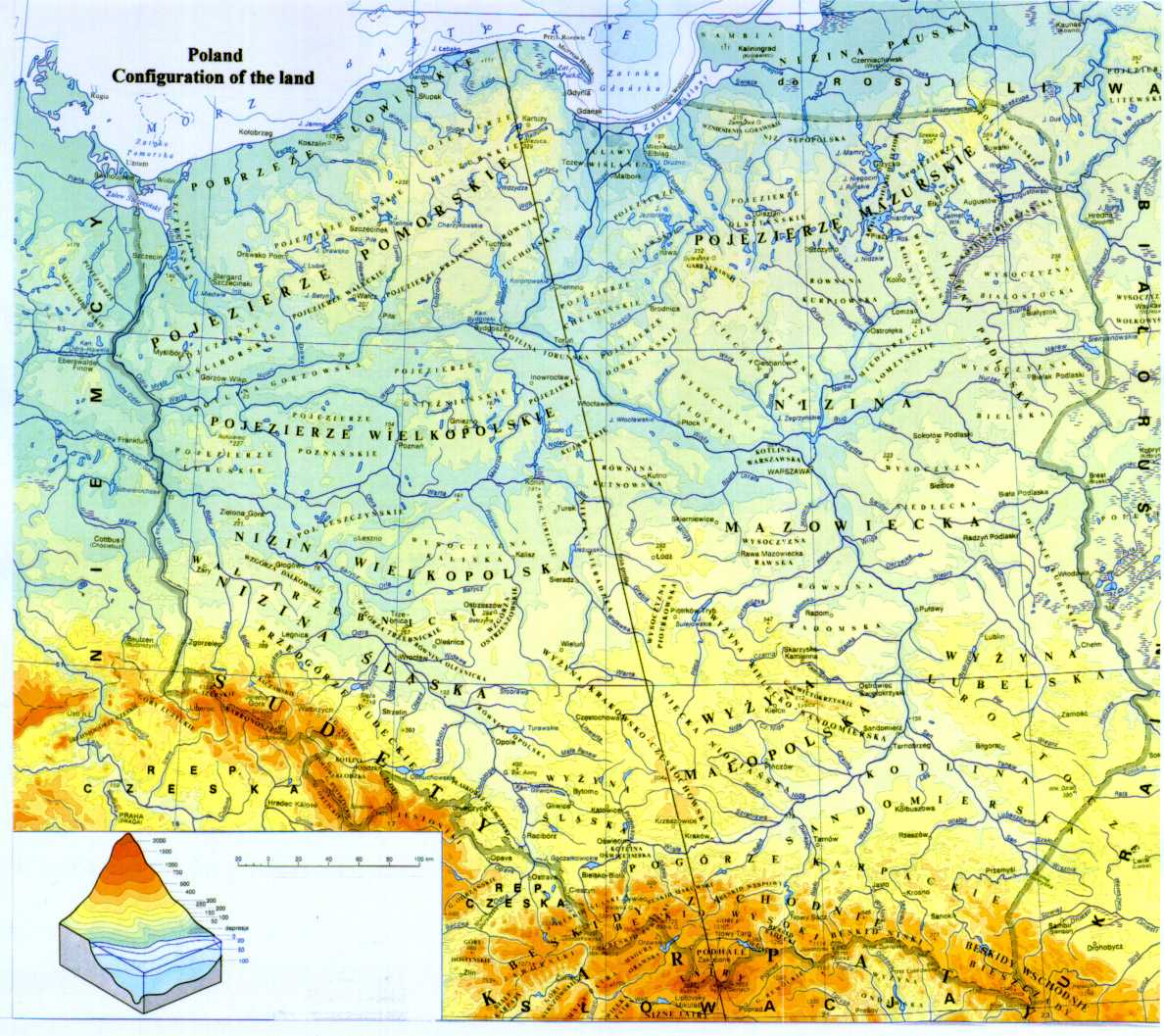
Poland: Land Configurations shows elevations 1188 x 1057 pixels - 217k fao.org/.../doc/Counprof/Poland.htm |
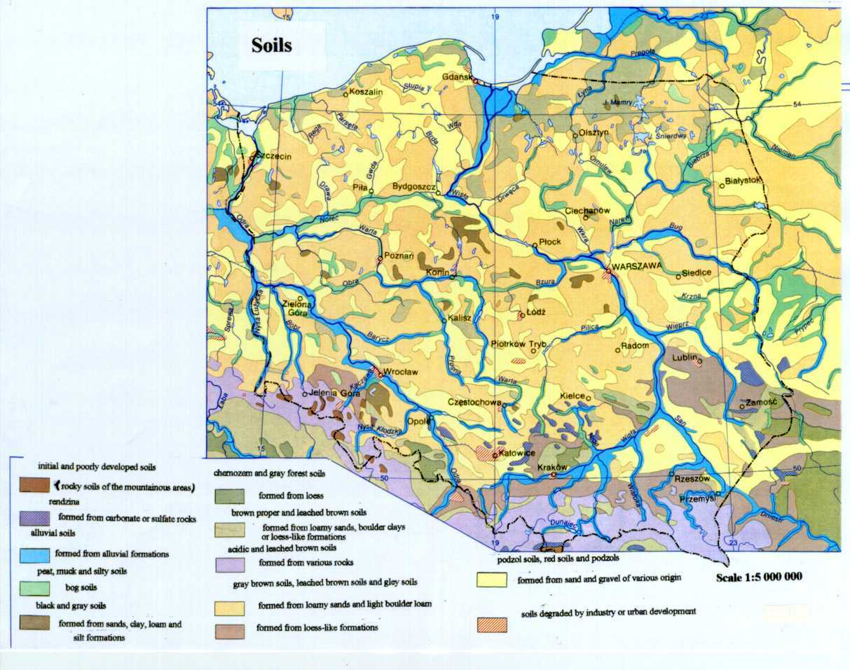
Poland: Soils showing tsoil types 300 x 362 pixels - 143k fao.org/../Counprof/Poland.htm...TOPOGRAPHY |
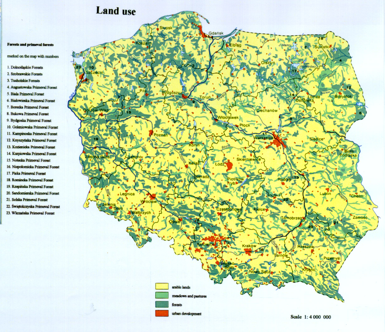
Poland: Land Use showing voivodships, powiats, gminy 1226 x 1057 pixels - 599k fao.org/../Counprof/Poland.htm...TOPOGRAPHY |
| Info-Poland a clearinghouse of information about Poland, Polish Universities, Polish Studies, etc. |