| Basic Information |
Poland in the World
|
| Maps of Poland |
POLAND shaded relief - size: 624 x 400 pixels
international boundries, towns, rivers, country statistics |
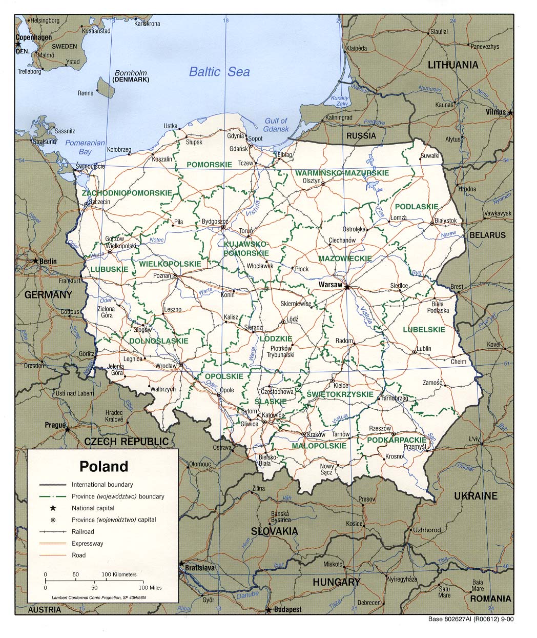
POLAND political - size: 1048 x 1244 pixels
international and provincial boundries, provincial capitals, railways, expressways, road, rivers
|
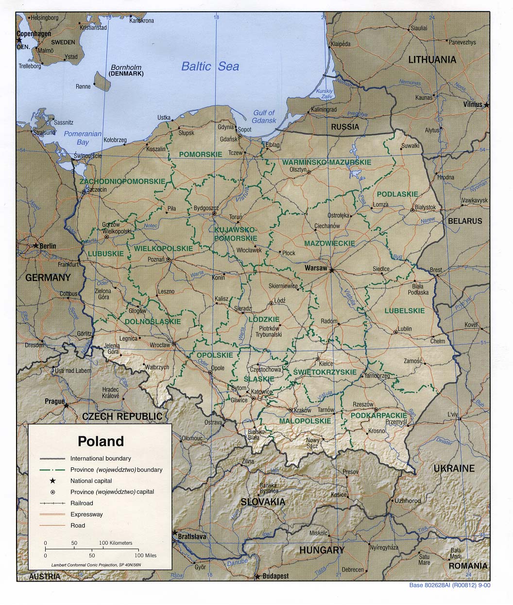
POLAND shaded relief - size: 1056 x 1244 pixels
international and provincial boundries, provincial capitals, railways, expressways, road, rivers
|
POLAND new provinces - size: 372-394 pixels
pre and post 1999 provincial boundries; listing of pre and post 1999 provincial capitals |
POLAND small and simplest - size: 351 x 377 pixels
national borders, major towns, adjoining countries.
|
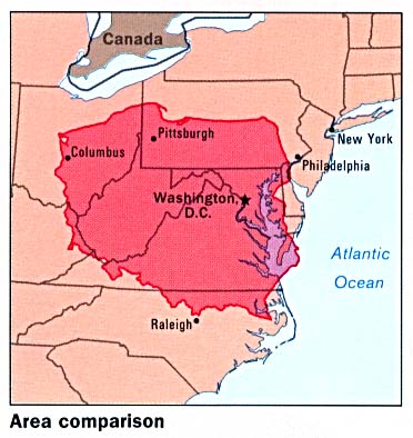
POLAND/USA area comparisons - size: 372 x 394 pixels
national and state boundries |
| Specialized Maps of Poland |
POLAND mineral resources - size: 663 - 606 pixels
|
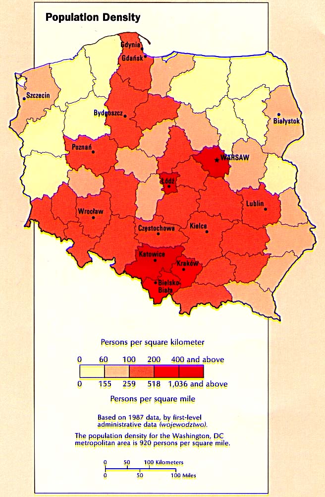
POLAND population density - size: 712 x 764 pixels
persons/sq kilometer (0,60,100,200,400, +) |
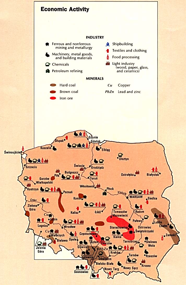
POLAND economic activity - size: 712 x 764 pixels
mining and metallurgy, shipbuilding, machinery, textile and clothing, chemical, food processing, petroleum refining, light industry, hard coal, brown coal, iron ore. copper, lead and zinc
|
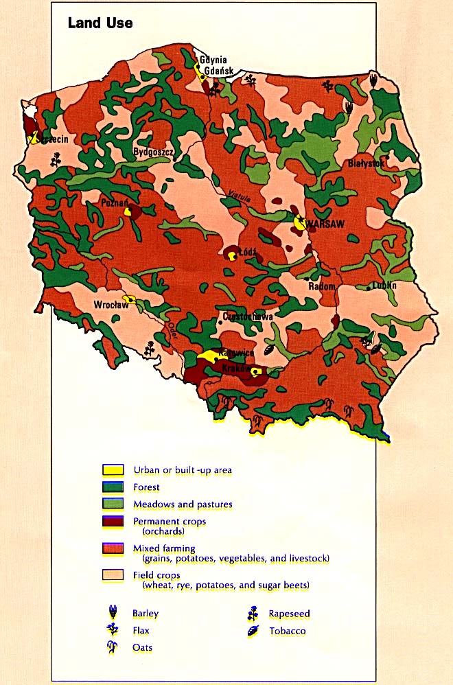
POLAND land use - size: 712 x 764 pixels
urban, forest, maedow, field crops, mixed farming, orchards |
| Central and Eastern Europe |
| OUTLINE MAP political (1999) - in pdf format
|
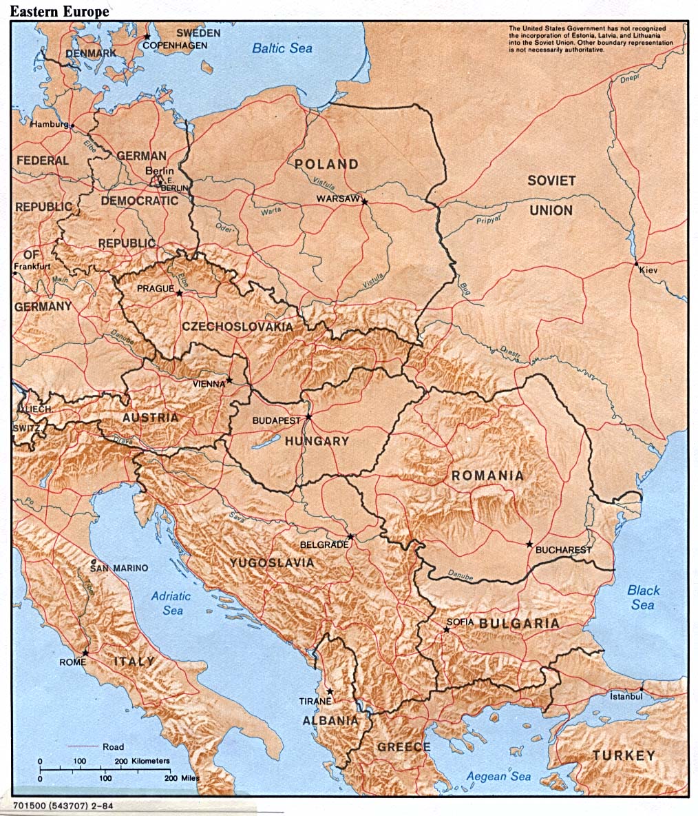
| RELIEF MAP shaded (1984) - size: 1014 x 11846 pixels |
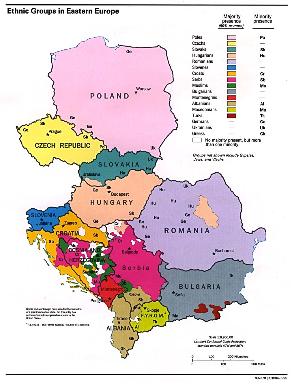
ETHNIC GROUPS 1995e - size: 1012 x 1326 pixels
Poles, Ukrainians, Germans, Checks, Slovaks ... |
| Cities and Towns |
| KRAKOW center/old town - size: 655 x 720 pixels
|
| WARSAW central area - size: 754 x 684 pixels |
WARSAW historical development - size: 822 x 1078 pixels
boundries in the 16th, 17th, 18-19th Centuries, in 1939, 1965, and at present.
|
| Historical Maps |
| EUROPE political - in June 1914 - size: 693 x 774 pixels
|
| Judaic History |
| JEWISH EXPULSIONS AND RESETTLEMENT AREAS
in Europe 1000 -1500 - size: 450 x 344 pixels
|
| EMANCIPATION OF EUROPEAN JEWRY
- 1789 to 1930 - size: 470 x 453 pixels |
POGROMS AND ANTISEMITIC ACTS OF VIOLENCE - in Russia and the Pale 1871-1906 - size: 450 x 435 pixels
|
JEWISH POPULATION OF EUROPE in 1939 - size: 470 x 410 pixels
|
KRISTALLNACHT
- German cities where synagogues were destroyed on on November 9, 1938 - size: 400 x 355 pixels
|
NAZI CREATED JEWISH GHETTOS in Europe - size: 378 x 378 pixels
|
RAILROADS LEADING TO AUSCHWITZ
- carrying victims to the Nazi concentration camp
- size: 491 x 484 pixels
|


 Maps
Maps